Stokes Bridge slated for replacement next spring

Nevada Daily Mail
Farmers inconvenienced by the flooding on the Stokes Road's low water crossing over Drywood Creek may have a solution by spring of next year.
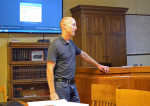
"MoDOT approved our preliminary plans," Travis Rapp, a structural engineer with Cook, Flatt & Strobel Engineers, said at the Vernon County Commission meeting Wednesday. "This week I'm going to be starting the final design for the beams and the substructure. We do have the location of the bridge abutments (which provide vertical and lateral support for the bridge) located. We hope to have the final plans done by the end of the year so construction can start when the season warms up."
A single span structure, anchored at each end with no supports in the middle, the bridge will slant 15 degrees and have thrie-beam guardrails, essentially two pieces of guardrail formed into one single shape.
"We won't have any tiers (columns) catching drift or debris," he said. "Our bridge will never be under water, so that's good. We're able to use three girder (beam) lines and pre-cast panels, which will really help speed up construction. The thrie-beam guardrail is more economical. I was kind of wanting the bridge to be straight; that's an ideal situation. But, then we'd be parallel with the creek and end up with a monster structure. The banks on the east side are pretty steep, so we're going to have to reshape them and so they won't give us any trouble in the future."
The cost for the new bridge and alignment of the road, changing steep curves to a bend, should cost around $450,000, according to Rapp. The county's share would be around 10 percent at $45,000, with the Missouri Department of Conservation paying up to $40,000 and the state paying the rest.
With the fund contribution, the conservation department will work with Vernon County to ensure the project improves fish and sediment passage in the creek.
During the meeting, Rapp asked the commissioners how far the right-of-ways for the road extend. After searching through the books, the commissioners and recorder Doug Shupe found no records existed.
"Most of the work will be on the Caldwells' side, so we'll be working on getting their permission," Rapp said. "Twenty-foot easements on both sides is the most common practice."
Presiding Commissioner Bonnie McCord asked for an update on the Department of Natural Resource's survey of the area for archaeological significance. Rapp said he had no news from DNR.
During a previous meeting, Northern Commissioner Neal Gerster said he was unsure as to why the area was selected for a survey, and that he didn't know how long an initial survey may delay the project. In a worst-case scenario, he said, state archaeologists would find something significant and the project could be delayed indefinitely.
Rapp added an approach slab might be needed to ensure asphalt on the road does not create a bump on the end of the bridge.
McCord told Rapp to find out the most common practice in dealing with asphalt and bridges on county roads before including the addition to the project.
